When you need to find your way around the Park, it is always best to have a map handy! (we’ve also included a few other handy maps not necessarily of Caesar Creek here)

Park Maps
Caesar Creek Campground Map (pdf)
Simple line map showing camp sites, lot numbers, and facilities; 8.5×14
DETOUR Mobile and Web App
This is the new interactive App for your phone! Select “Perimeter Loop Trail,” one of Ohio’s Featured Routes, or type “Caesar Creek” in the search window.
Caesar Creek State Park (pdf)
Simple line map showing roads, facilities, primary trails. ODNR. 8.5×11
Trail Maps
Pedestrians are welcome on all trails. Mountain bikes are expected to stay on mountain bike trails and horses are expected to stay on bridle trails. Thank you.
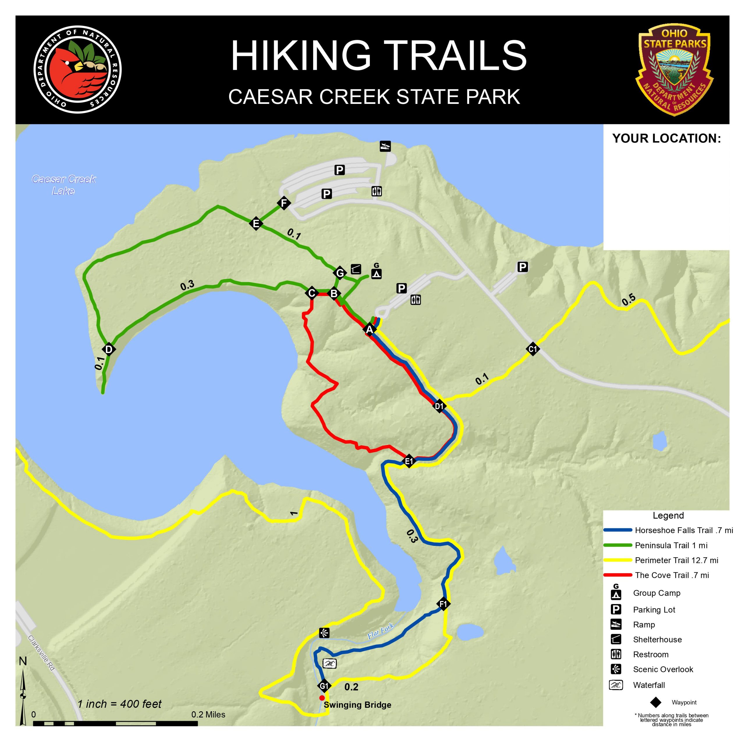
Wellman Area Trails (pdf)
ODNR Trail Map; shows trails in and near the Wellman Boat Ramp with topographic shading; 12×12; Horseshoe Falls is on this map near the south edge.
Mountain Bike Trail – Campground to Harveysburg (link)
Link goes to interactive map furnished by mbtproject.com; opens in new tab
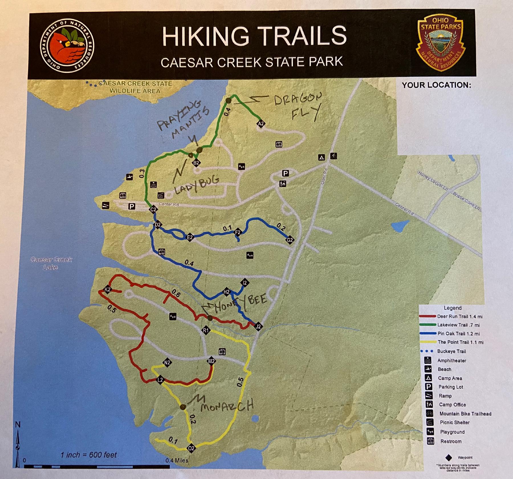
Campground Trails (pdf)
ODNR Trail Map; shows trails in and near Campground with topographic shading; 12×12
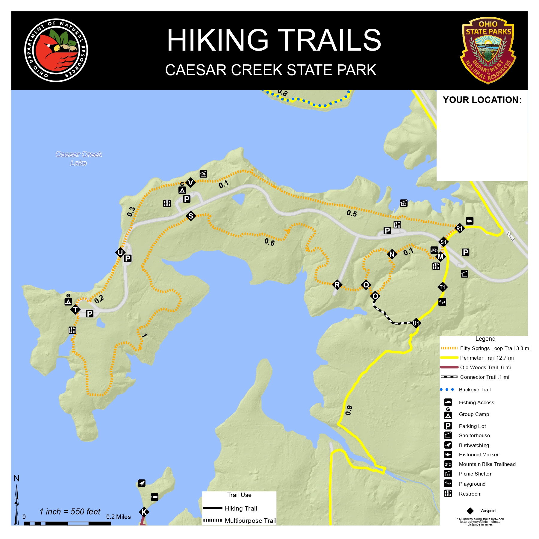
Fifty Springs Loop Trail (pdf) (Multi-Use Trail Mountain Bikes permitted)
ODNR Trail Map; shows trails in and near Fifty Springs area; topographic shading; 12×12
Bridle Trails (pdf)
Simple line map of bridle trails and Horseman’s Camp; provided by WC OHC; 11×17
Old Woods Trail (pdf)
ODNR Trail Map; shows Old Woods Trail with topographic shading; 8.5×11; This area is environmentally sensitive and may be closed. 12×12
Perimeter Trail (pdf)
ODNR Trail Map; shows Perimeter and other trails between SR 73 and Caesar Creek Dam with topographic shading; 12×12 (No bikes please)


Hunting and Fishing Maps (includes Boat Ramps)
ODNR Documents and Publications
Link goes to ODNR library of documents and publications; go here for up-to-date hunting and fishing information; opens in new tab.
Caesar Creek State Park hunting map (pdf)
Official Hunting Map, effective 20 Sep 2019; multi-color, hunting areas in green and yellow, Non-Hunting areas in red; 11×8.5
Caesar Creek Lake fishing map
Shows shoreline, boat ramps, and facilities; revised 2018; 17×11
ODNR Wildlife Area Maps
Spring Valley Wildlife Area map (pdf)
ODNR Wildlife Area map with area description; 14×8.5
Caesar Creek Lake Wildlife Area map (pdf)
ODNR Wildlife Area map with area description; 14×8.5
Public Hunting and Wildlife Area Maps
Link goes to statewide index of downloadable maps


Other Maps
Little Miami State Park (pdf)
Simple line map showing roads, facilities, primary trails. ODNR. 8.5×11
State Trail Map (link)
Link goes to a highly interactive map provided by the Ohio Department of Natural Resources, zoomed in to the Caesar Creek Lake area; opens in new tab
Ohio Wildlife Map
In the left sidebar, choose “Lake Name” at the “Select query” box and then enter “Caesar” in the “Search For” box
Cowan Lake State Park (pdf)
Simple line map showing roads, facilities, primary trails, and topography. ODNR. 8.5×11
Cowan Lake Campground Map (pdf)
Simple line map showing camp sites, lot numbers, and facilities; 14×8.5

Contacts
- General Park Information
- Website
- Phone: (513) 897-3055
- Campground Information
- Nature Center Information:
- Phone:(513) 897-2437
- Nature Center Field Trip Information
- Phone: (513) 897-2437
- Marina Information
- Information
- Phone: (513) 897-1092
- Park Facility Rental:
- Website
- Phone: (513) 897-3055
- Visitor Center Information
- Information
- Email:
- Phone: (513) 897-1050
- Nature Center Association Inquiries
- Phone: (513) 855-2120
- Event Inquiries
- Phone: (513) 855-2120
Gallery


Interested in becoming a Member of the Nature Center Association
If you are interested in how you can become a Member of the Nature Center Association, if you would like more information, select the Contact Us button below. If you are ready to become a member and don’t have any other questions, click on the Membership button below.